![]()
Founded 1906
BHAS
Field Unit News 2005
Page 2
|
|
|
|
|
|
|
|
|
|
|
|
|
|
|
|
|
|
|
|
|
|
|
|
|
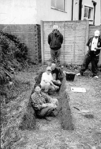
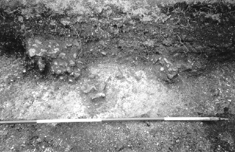
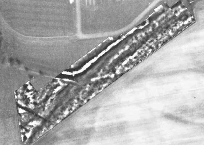
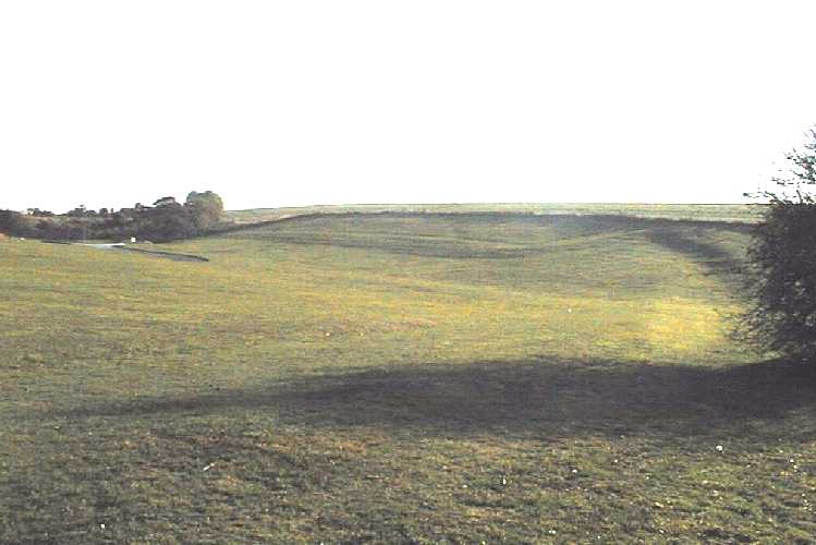
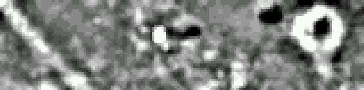
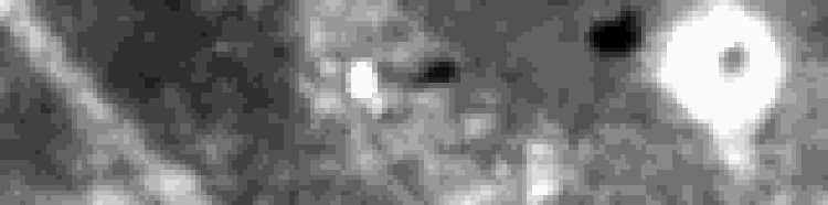
* Original Information Jan 2005 * added June 2005 * added July 2005 * added September 2005 * added October 2005 * added December 2005 During the early part of January members of the BHAS Field Unit joined Paul Clements, a student form Winchester, in a survey of lands to the south of Truleigh Hill. During a summer walk, two seasons ago up to the top of Thundersbarrow Hill, it was noted in the low setting sun that this part of Sussex is adorned with numerous earthworks and lynchets associated with ancient settlements. The area has remained virtually intact and untouched as a result of its distant location and inaccessibility. The new survey is examining a field system that appears to be within a large rectangular enclosure. A number of aerial photographs show the features clearly defined. A cursory examination of the earthworks noted that as well as the large lynchets there are a number of circular platforms cut into the slope of the hill. The excavations at Downsview, Coldean and Varley Hall produced a number of Bronze Age round houses cut into the side of the hill in the form of house trerrace. It is possible that these features are similar remains. Paul is seeking evidence for a chronological sequence for the earthworks, as a numbr of the field boundaries tend to overlay each other. The geophysics has been undertaken using Paul's RM15 resistivity machine, and BHAS team leader David Staveley using his 'TR' systems machine. The results, (fig1 and fig2) using David's 'snuffler' software are have been quite exciting. The survey will continue for a few more week- ends or until Paul has to return to Winchester. EXCAVATIONS AT NANSON ROAD, COLDEAN In April of 2005 the BHAS Field Unit were asked to conduct a watching brief on a development at Nanson Road, Coldean. The unit were, with the kind permission of the land owner, allowed to excavate a small trench in a section of the garden prior to the commencement of the building works. The area investigated appeared to have been untouched by garden terracing. The trench (photo 1) which measured 3.5 metres by 1.5 metres produced three different layers comprising an overburden of a dark, silty fill containing numerous finds of contemporary material including glass, slate tile and other building debris. The lower layer produced a pair of small mounds of flint nodules, flint flakes and 9 sherds of Iron Age pottery. The lower fill was only a few millimetres thick and produced a single flint flake. However, cut into the chalk below the fills was a flint packed post hole. (photo 2) During the construction of the Coldean estate in the 1950's workmen had found a number of ditches and an Iron Age round house. The BHAS who had been excavating a Bronze Age barrow along the Ditchling Road had been asked to investigate the features revealed. It appears that Coldean contains not only Bronze Age activity, including a settlement site and a possible cemetery, but also features dated to the Iron Age and Romano-British periods. The exact extent of the sites, from each period, is not known but every opportunity to investigate the gardens provides valuable information. In the past few years Bill Santer has conducted a number of watching briefs in the area with out very much being found. The new excavation clearly indicates that the west side of the valley was being utilised and the focus of any settlement during the Iron Age appears to be a plateau area above a small valley depression running down to the old Coldean farm. We deeply appreciate the efforts of the watching brief team and those who conducted the excavations over the following week-end. The dig at Nanson Road has provided very useful additional information in the form of finds and features to enhance the ephemeral knowledge that we already possess. We would also like to thank Mr Voller, the land owner, for such a positive attitude towards archaeological investigations. A full report has now been produced. In early May 2005 the BHAS Field Unit responded to a request from the County Archaeologist and Greg Chuter for help with a site on Malling Down. The Lewes Rangers had been scrub cleaning and when bushes had been removed found that rabbits had been eroding human bones. Over a bleak week-end of intermittent drizzle and rain members of the unit conducted an excavation on a small platform area on the steep scarp side of Malling Down. Two small trenches were cut and the excavations produced a total of 9 burials. The site was immediately adjacent to an earlier trench that had been cut in the 1970's that had produced 12 burials. (see photos) It soon became apparent that these were no ordinary burials, from a total of 9 bodies in the new excavation only 1 head was recovered. As the dig progressed the people who had been buried were observed to have had their hands tied behind their backs. There was a small area between the old and new excavations that was free of any skeletal remains. It would appear that the burials were execution victims. It would seem that the young men, our bones team who are examining the remains trend to confirm this, were marched up the hill and then beheaded, their bodies being thrown into a number of shallow pits. A solitary buckle found at the junction of one of the leg and feet bones tend to suggest that these were people associated with the battle of Lewes 1264, and were probably prisoners of the battle. They were executed on this elevated spot no doubt to emphasise, to those watching in the valley below, the cost of losing the battle. It was a poignant thought that as we stood on Malling Down and looked towards Lewes Castle, and the medieval churches of Hamsey and Barcombe, that this was the last view that these poor wretches saw just before their tragic ends. WOODINGDEAN CEMETERY PROJECT 2004 /2005 The Lawn Memorial Cemetery at Woodingdean was opened in 1963 without any consideration for the ancient landscape it was placed on. Aerial photographs taken over a period of time clearly showed human activity changing the natural landscape to the south of the cemetery, evidenced by an linier earthen bank running east/west. A Geophysical survey was carried out by the Brighton & Hove Archaeological Team during 2004 (see photo) . The results of this survey raised many questions, the pictures (photo 1 & photo 2) produced indicated possible ancient activity but was this natural or man made? It was agreed by the city council and the East Sussex County Archaeologist that a series of investigation trenches should be placed, cutting possible archaeological features. This was carried out by the BHAS field unit during 2004 and 2005, producing evidence of ancient human activity as well as an ancient geological landscape which was laid down approximately 10,000 years ago. The data produced from the investigation has shown that the area formally recorded on the 1860 Tythe map as sheep pasture has been actively used for agriculture over centuries. The finds excavated from the test trenches indicate that the area was used during the Iron Age Period and possibly even earlier. The excavated data is being analyzed at this time and a report will be sent for publication on completion. Phase One: Woodingdean Cemetery The remaining investigation trenches were placed and excavated during the early part of 2005. Finds are being cleaned and evaluated. Report forthcoming Phase Two: Field south of Cemetery This field contains an ancient field system of probable iron age date, fieldwalking was carried out by members of the field unit during September and October 2005, approximately just under one half of the area was walked. This proved to be difficult for the team due to the field not being ploughed and contained crop stubble, only a small amount of ancient materials were located. These are being evaluated. The remainder of the field which contain settlement will be fieldwalked during 2006. Phase three: The field west of the cemetery area had a resistivity survey carried out by members of the geophysics team during October 2005, the results indicate that there is a possible enclosure within this field additional resistivity will need be carried out this year to pick up the full feature. In 2004 the Brighton and Hove Archaeological Society were asked by various people whether they would be willing to work with metal detectorists. Brighton and Hove City Council had a policy of not allowing metal detectorists on their lands. As a result of several meeting with the Council, the County Archaeologist and the Brighton and District Metal Detecting Club our Society now work very closely with B&BMC. Metal detecting will now become part of our research programme along with field walking and geophysics. The metal detecting will use the grids set out for field walking and surveying and metal finds locations will be recorded within those frameworks. Metal detecting concentrations will be noted on similar presentations to that made with field walking. A large number of the B&DMC have become members of the BHAS for insurance purposes and already a number of projects have taken place in the fields surrounding Rocky Clump. Sadly we have to report that although there has been a significant amount of lead finds, mainly globules and cast pieces, there have been few Roman finds as yet. Among the items found by detecting have been a number of lead tokens, some pewter buttons and a few musket balls. It is hoped that more spectacular finds will be recovered in the future. Metal detecting will be a very important part of the BHAS future programme, and we are delighted to report that Bob Bird, one of the detectorists , has also been actually digging! Bob, Derek, Dave, Marlene, Pauline and the other members of B&DMC will be regular visitors to all our projects. In December of 2004 a visit was made to Beacon Hill, Rottingdean to examine some earthworks. Crispin Kirkpatrick, one the Brighton Rangers had noted a number of earthworks after the hill had been mown. The hill which is noted both for the windmill and the mini-golf course is now part of a local nature reserve. The hill possesses two possible Neolithic long barrows and a dew pond. The features noted in December of 2004 included a platform cut into the west facing side of the hill and a number of circular features on the summit of the hill close to site of one of the long barrows. In late August 2005 the geophysical team of the BHAS Field Unit, led by David Staveley, conducted small survey of the features noted to try and determine the nature and possible date of the earthworks. Although Beacon Hill has Neolithic features when the windmills were constructed a burial was found but is of indeterminate date. The hill being close to the coast may also have had any number of Second World War anti-invasion devices. While the survey was being conducted we were visited by Mr John Cummin, a local counsellor, who informed us that in the past the hill was the location for an important beacon location. This 'beacon hill' managed to send messages off in not one, but two different directions. Another past local tells us of a depression that was regarded as the gun emplacement. The results of the survey are very interesting. The platform cut into the side of the hill has an area of very high resistance but no distinctive configuration. The survey on the top of the hill however (Fig 1 Flat , Fig 2 Non-Flat, Fig 3 Flat and Fig 4 Non-Flat ) produced evidence for a number of features. The main earthwork to the east has a very large circular area of high resistance with a 'tail', this David believes may be the location of another windmill. The central area produced a number of interesting anomalies including a ditch that appears to run towards the location of the long barrow. It is obvious that this hill will have be the subject of a major survey, and that some small trenches may have to be cut into the features found to produce some dating evidence. A permit has been received from Brighton & Hove City Council to conduct a geophysical survey over the whole of Beacon Hill, but additional permission will need to be sought to survey the long barrow to the north of the golf course and for any planned exavations. The survey has been a very useful research project and Beacon Hill will now become part of a larger investigation to be conducted over a number of seasons. In November 2005 members of the BHAS Field Unit assisted Matt Pope with a resistivity survey of lands within the Iron Age hill-fort. The project is looking for possible evidence for ritualistic activity. Matt has observed that the sun rises in mid-summer in alignment with the east opening of the enclosure, is there some significance. The interior of the hill fort has been considerable cleared allowing a large scale survey tom be conducted for the first time. The survey included a study of the earlier origins of a smaller enclosure possibly dated to the Bronze Age. There is currently some speculation as to whether the hill-forts in Sussex are for ritualistic rather than defensive purposes, although of course they could have been both. Hollingbury has a number of barrows within its interior and Sue Hamilton has suggested similar panoramic connotations at Caburn. The results of the survey have proved very interesting with the location of a possible square shaped structure. The survey will have to be extended to survey the remaining section which is still under gorse cover. The survey will continue in 2006. The project will be written up by Matt Pope. |
||||||||||||
|
For news prior to January 2005 , please see the Field Unit Archive |
||||||||||||
|
|